
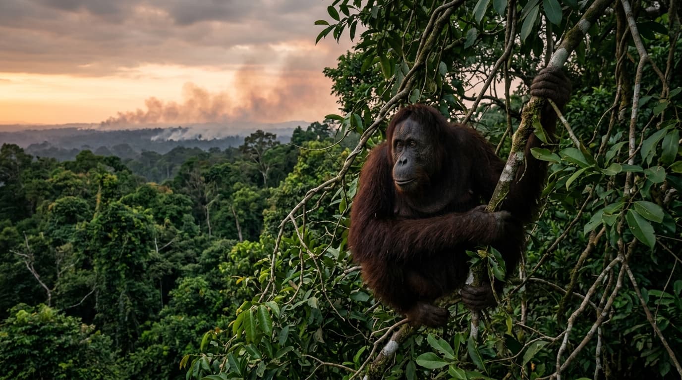
Understanding 'Karhutla': Fire, Peat, and Human Pressure
In Indonesia, the acronym 'Karhutla' stands for Kebakaran Hutan dan Lahan—forest and land fires. For decades, satellite monitors and international environmental reporting by Mongabay and Reuters have tracked seasonal fire spikes across Sumatra during dry spells and El Niño climate cycles.
However, there is a fundamental ecological distinction that every traveler and nature advocate must understand: pristine primary tropical rainforests, such as the mineral-soil jungles of Gunung Leuser National Park around Bukit Lawang, do not naturally burn. They are dense, multi-canopy ecosystems with extremely high humidity and year-round moisture.
The catastrophic fires that make global headlines occur almost exclusively in drained peat swamp forests and converted agricultural frontiers—particularly in the lowland coastal basins of South Sumatra, Riau, and the western peat swamps of Aceh.
| Feature | Gunung Leuser (Bukit Lawang) | Drained Peat Swamps (Tripa / Singkil / Riau) |
|---|---|---|
| Ecosystem type | Primary montane & lowland rainforest | Peat swamp forest & converted agricultural land |
| Soil composition | Mineral soil & deep root networks | Layers of dead organic plant matter up to 10m deep |
| Fire behavior | Naturally fire-resistant; extremely rare | Deep subterranean smoldering; nearly impossible to douse |
| Primary threat | Border encroachment & poaching | Artificial drainage canals & slash-and-burn clearing |
| Orangutan impact | Core sanctuary with continuous canopy | Habitat fragmentation, starvation, and displacement |
Why Peatland Fires are an Ecological Catastrophe
Tropical peatlands are Earth's most efficient terrestrial carbon sinks. Over millennia, layers of dead vegetation accumulated in waterlogged conditions, locking away billions of tons of carbon. When agricultural interests dig deep canals to dry out these swamps for monoculture estates, the peat dries into combustible organic fuel.
When an illegal fire is ignited on dried peat, the blaze moves underground. Surface flames might appear extinguished, yet meters below the soil, smoldering heat can travel for weeks, releasing choking PM2.5 particulate matter and greenhouse gases on a staggering scale.
The Leuser Ecosystem contains three vital coastal peat swamps: Tripa, Kluet, and Rawa Singkil. Known to biologists as 'the Orangutan Capital of the World,' these lowlands historically supported the densest wild populations of the Critically Endangered Sumatran orangutan (Pongo abelii).
- Loss of canopy highways: Orangutans are strictly arboreal. When tree canopies burn or collapse, their movement corridors vanish.
- Starvation and malnutrition: Intense heat and smoke destroy wild fig trees, lianas, and fruiting cycles that orangutans rely upon.
- Toxic smoke inhalation: Like humans, primates suffer acute respiratory infections (ISPA), eye damage, and lethargy from persistent PM2.5 haze.
- Human-wildlife conflict: Displaced, starving orangutans are forced into community oil palm and rubber farms, drastically raising the risk of poaching and retaliatory capture.
Regional Haze: What Travelers Need to Know
European travelers planning a trek in North Sumatra often worry whether regional haze will disrupt their journey. Indonesia's meteorological agency (BMKG) and disaster agency (BNPB) monitor fire hotspots closely, deploying cloud-seeding aircraft and ground firefighting units (Manggala Agni) during peak dry months (typically July to October).
Because Bukit Lawang sits nestled directly against the foothills of the Barisan mountain range and within intact rainforest, local air quality under the jungle canopy remains remarkably fresh. The mountain topography and daily forest transpiration create a localized microclimate that insulates the valley from the heavy industrial haze seen in distant lowland cities like Palembang or Pekanbaru.
- Normal operations: Jungle trekking and wildlife viewing in Bukit Lawang continue safely year-round.
- Packing tips: Bring high-filtration masks (such as N95 / FFP2) for transit days through major provincial airports or during road transfers if regional smoke is reported.
- Transparent communication: Our team monitors real-time air quality index (AQI) reports and national park advisories daily.
How Ethical Ecotourism Acts as an Anti-Fire Shield
The root cause of agricultural burning is economic desperation. When rural communities living along the fringes of the national park lack sustainable livelihoods, selling land to speculative plantation developers or clearing plots with cheap fires becomes a survival temptation.
Ethical ecotourism reverses this economic incentive completely. In Bukit Lawang, former rubber tappers, plantation workers, and even former illegal loggers now earn dignified, steady incomes as professional guides, rangers, cooks, and porters.
When a local family's prosperity depends directly on foreign travelers coming to see healthy wild orangutans in a thriving forest, every villager becomes an active guardian of the tree canopy. The standing rainforest is recognized as infinitely more valuable alive than cleared.
Every official permit and trek package directly supports local ranger stations, community fire alert groups (Masyarakat Peduli Api), and boundary monitoring along the Gunung Leuser National Park.
How Conscientious Travelers Can Help
Responsible travel goes far beyond minimizing plastic waste on the trail. By making conscious decisions before and during your journey to Sumatra, you directly fortify rainforest defense.
- Choose certified, local-first guide teams who respect wildlife buffer distances and national park permit laws.
- Never support operators who feed, call, or bait wild orangutans for tourist selfies.
- Support grassroots conservation organizations on the ground in Sumatra, such as the Orangutan Information Centre (OIC) and Forum Konservasi Leuser (FKL), who restore drained peat canals and reforest degraded buffer zones.
- Share verified knowledge about Sumatra's peatlands and advocate for zero-deforestation supply chains back home in Europe.
Frequently Asked Questions
Is Bukit Lawang currently safe from forest fires?
Yes. Bukit Lawang is located in an intact, primary rainforest ecosystem surrounded by mountains. Fires in Sumatra occur predominantly in distant lowland drained peatlands. Treks in Bukit Lawang operate safely with fresh air under the forest canopy.
What months have the highest risk of regional haze in Sumatra?
The dry season between July and October, especially during El Niño years, sees the highest regional hotspot counts. However, morning mountain breezes and afternoon rain showers in Gunung Leuser consistently cleanse the local air.
How does my trek fee help prevent forest fires?
Trek fees include official Gunung Leuser National Park entrance permits and provide fair livelihoods for local guides and villagers. This creates an economic alternative to agricultural land clearing and funds border surveillance against encroachment.
Where do displaced orangutans go when fires occur?
Conservation groups like OIC and government rescue teams tranquilize and translocate displaced orangutans from fire-damaged edges into protected, contiguous sanctuaries within the Leuser Ecosystem.
Ready to compare trek options?
Use the booking pages to choose a route, confirm transport from Medan, and send your dates before paying a deposit.